No Ruins, No Problem: Reconstructing Pathyris with Papyri and 3D Models
For centuries, the story of Pathyris has remained largely untold—the town’s layout, stories of the individuals who lived there, and any other secrets lying within yet to be explored. Now, a groundbreaking project aims to digitally resurrect this unique piece of history, preserving its story and deepening our understanding of life in the Ptolemaic period.
Dr. Aneta Skalec is a papyrologist, archaeologist, and expert in Roman law. As the lead investigator of the Ptolemaic Pathyris Project, she is working with a team of four colleagues: Dr. Wojciech Ejsmond (her mentor), Dr. Julia Chyla (GIS expert), and two scholarship holders, Jakub Stępnik and Łukasz Suski to conduct interdisciplinary research on the urban layout and residential architecture of Pathyris under Ptolemaic rule (322–30 B.C.). Their study is based on a wide range of data, including archival, papyrological, and geospatial sources.

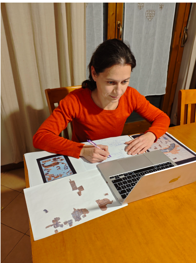
Dr. Aneta Skalec studying archival sources
The team is investigating Pathyris, a capital of an ancient Egyptian territorial division called “nome”, located about 30 km southwest of Luxor. Interestingly, Pathyris was also a garrison headquarters during the 2nd and 1st centuries B.C., until it was seized and destroyed in 88 B.C. The settlement developed on the top,the western slope and at the foot of the Eastern Mountain of Gebelein. Pathyris is particularly well known thanks to a large number of Greek and Demotic papyri, ostraca and wooden tablets found in archives maintained by town authorities, temples, and individual families.
Despite its significant presence in written records, Pathyris has remained largely unexplored by archaeologists. Unfortunately, the use of dynamite to clear the land for modern housing has irretrievably damaged most physical traces of the ancient town, which makes archaeological exploration difficult. However, this does not mean that it is impossible, and the Ptolemaic Pathyris Project team takes on the challenge to understand the town’s topography and architecture despite the lack of physical evidence. Previously unpublished archival sources from the Italian excavations conducted at the site in 1910, as well as papyri containing topographical information, provide valuable insights.
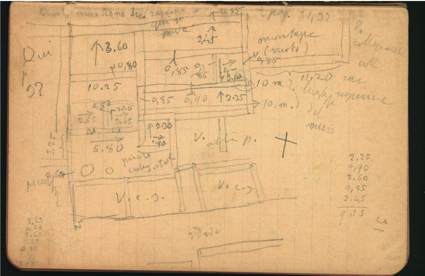
Having started less than a year ago, Dr. Skalec and her team are working diligently to collect information and are achieving important milestones in their goal of reconstructing the town. For example, Dr. Skalec has already managed to read and translate from Italian an archival excavation diary from 1910, which is an invaluable source of information about the architecture of the site. The diary contains detailed sketches of both houses and the fortress towering over the town, with measurements of each wall, as well as with information about stairs, ovens, or large jars.

Example of an archival field journal studied as part of the Ptolemaic Pathyris Project
Additionally, she has analyzed over 1,300 papyrological documents originating from the town (including unpublished material made available to her courtesy of other researchers) in research of terms relating to the topography and architecture of the town (names of districts, streets, owners of houses and vacant plots, temple and house elements, etc.). The documents identified in this way will be further analyzed and added to the database of topographic terms related to Pathyris, which they are creating together with Łukasz Suski.
The excavation diary, together with archival photographs, will constitute the basis for the 3D reconstruction of Pathyris, which itself will be placed on the Digital Elevation Model (3D graphics representation of terrain), currently being developed by Kuba Stępnik. In this way, the team will be able to understand not only its architecture, but also how the town adapted to the topography of the hill on which it developed.
All material analyzed and researched as part of the Ptolemaic Pathyris Project will be combined and included in the 3D reconstruction of the town as annotations with links to archival photos and papyri that contain geospatial information. With their findings organized in this way, theteam will have a unique opportunity to not only reconstruct the town’s topography and architecture, but also to see it through the eyes of its Ptolemaic inhabitants such as Apollonia, Dryton, or Petearsemtheus. These annotations will also simultaneously serve as the contextualization of hundreds of documents from the site, acting as an invaluable resource for future research and study.
Dr. Skalec has shared her work at numerous conferences, such as Current Research in Egyptology 2024 or 30th European Association of Archaeologists Annual Meeting, and also at workshops or seminars. She aims to popularize information about the project among non-experts, and has done so by participating in a broadcast in the Eureka program for Polish Radio, presenting a lecture on Apollonia–a businesswoman from Pathyris–for high school students, as well as a writing a popular science article for archeowiesci.pl. Outside of her research, she loves to spend time with her children, meet up with friends, and catch the occasional theatre performance or concert. She loves travelling and discovering new cultures, and with a rare break from academic reading and research, you can find her reading a report or crime novel.
Check out the Ptolemaic Pathyris Project official website: (https://pathyris.iksio.pan.pl/) to learn more about the project, archival sources, and news on the research team’s latest findings.